Real-time Hydro-environmental Modeling and Visualization System
for Public Engagement
Principle Investigators:
- Prof. Joseph Hun-wei Lee
- Dr. Wenping Wang (Department of Computer Science, HKU)
For more information on this project, please visit the website in Area of Excellence
![]()
Introduction
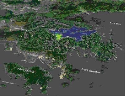
Environmental sustainability is critical to the economic development of Hong Kong and the Pearl River Delta; it can only be achieved with the aid of reliable decision support tools. In particular, quantitative impact assessment plays an important role in the sustainable development of our coastal and marine resources. Worldwide there is currently no robust model for satisfactory risk assessment and effective communication of environmental impact to the stakeholders. For environmental risk assessment it is necessary to predict the impact of effluent discharges for a wide range of discharge and ambient conditions. For many densely populated coastal cities in China and other Asian Pacific countries, the effluent discharges are typically located in relatively shallow waters of 5-20 m depth, close to sensitive receivers (e.g. mangroves, fish culture zones, beaches). Hence impact assessment tools must be able to cater for both the near field and the far field. Current industry-standard models cater for only the near field or only the far field, and the coupling of the near and intermediate/far field prediction methods is still not resolved.
The objective of the project is to develop a cutting-edge real time GIS based and integrated 3D hydraulic-virtual reality (VR) environmental modeling system. The unique technology will enable (i) robust and seamless 3D environmental impact prediction from near to the far field; (ii) full integration with GIS data and advanced visualization capability; and (iii) effective communication and public engagement.
There are two major components in our system, namely the new DESA method for dynamic coupling of near and far field, and the visualization of the simulations and predictions with GIS integrated 3D virtual reality.
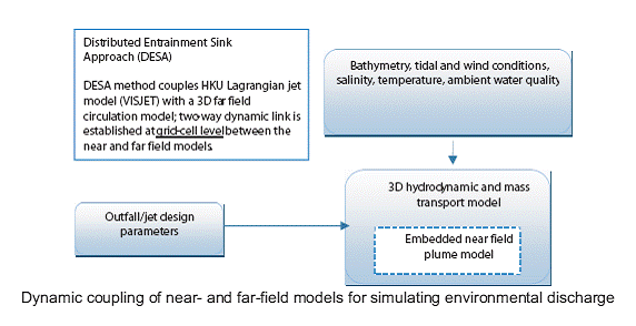
Click here for more information about DESA
|
VISJET Prediction |
Laboratory Observation LASER Induced Fluoresence(LIF) |
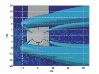
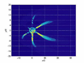
Near field Top view of a rosette jet group
|
VISJET Prediction |
Laboratory Observation LASER Induced Fluoresence(LIF) |
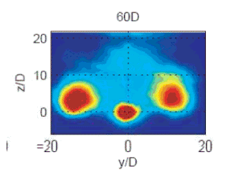
Cross-sectional view of a rosette jet group
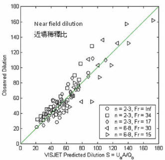
Comparison of predicted and observed near-field dilution of a rosette jet group
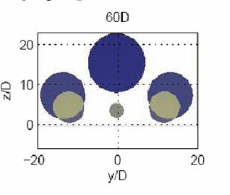
|
VISJET Prediction |
Laboratory Observation LASER Induced Fluoresence(LIF) |
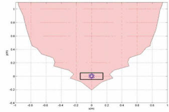
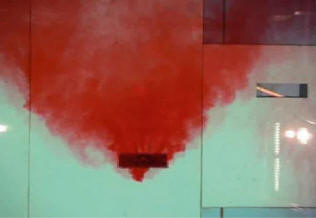
Comparison of the predicted buoyant surface layer with experiments
The visualization of the predictions of the 3D modeling engine is fully integrated with the GIS information. The technology involves data visualization, geometric modeling and real-time rendering based on dynamic scheduling of multi-resolution data with smooth transition between different resolution levels.
3D virtual reality with flexible and intuitive navigation and visualization of simulation data.
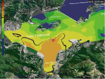
Standard threshold concentration contours are used to indicate affected areas.
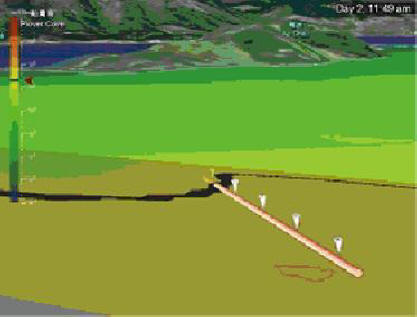
Near and far field interaction modeled by VISJET/DESA system.
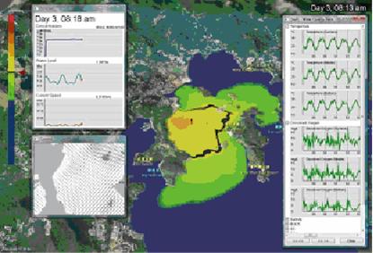
The time history of water quality data and the predicted concentration at a sensitive receiver
(e.g. a fish farm in Port Shelter).