Investigators:
- Prof. Joseph Hun-wei Lee
- Dr. H.W. Tang
- Dr. C. P. Kuang
Introduction
The Yuen Long Bypass Floodway is proposed to divert flood flows from the
Sham Chung River, the San Hui River, and part of the flow from the Yuen
Long Main Nullah into the Kam Tin Floodway. A 1:50 undistorted Froude
scale model and numerical model are designed and constructed to study
water levels and flow characteristics in the model flood way, and to
investigate optimal design arrangements at channel junctions and
transitions. Special emphasis is placed on the complicated flow
interactions at channel junctions, which cannot be resolved by
mathematical models of unsteady flow in commercial use.
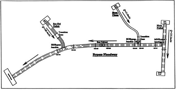
Fig.1 Yuen Long Bypass Floodway model
|
Parameter |
Prototype/Model Ratios |
|||
|
Length Lr=Yr |
50:1 |
|||
| Velocity Vr |
7.07:1 |
|||
|
Discharge Qr |
17678:1 |
|||
|
Reynolds Number (Re)r |
354:1 |
|||
|
Roughness Coefficient nr |
1.92:1 |
|||
Five schemes were compared, the results indicate that :
-
The use of a diversion channel with appropriate length and width is successful in diverting the required flow from a supercritical flood stream into the Floodway;
-
The use of a hydraulic structure to create a local constriction and nearly critical flow conditions at the San Hui junction has the effect of significantly bringing down the stage in the Floodway upstream while still allowing the passage of the required flood flow;
-
The best choice can enhance the flood control capacity from that of a one in 10-year to a one in 200-year flood.
|
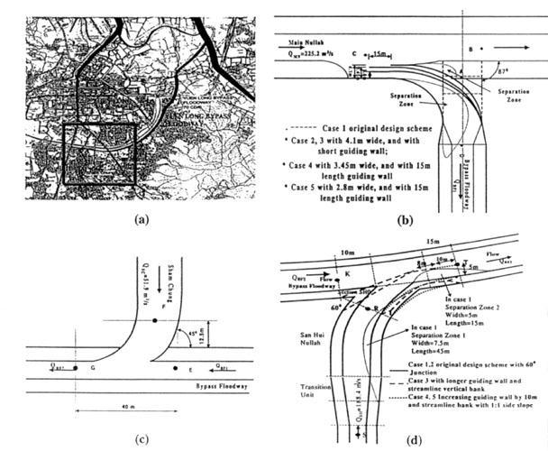
Fig.2 Schematic diagram of Yuen Long Bypass Floodway junction details a) Upper Yuen Long Catchment b) Main Nullah/Bypass Floodway c) Sham Chung/Bypass Floodway d) San Hui/Bypass Floodway |
||
|
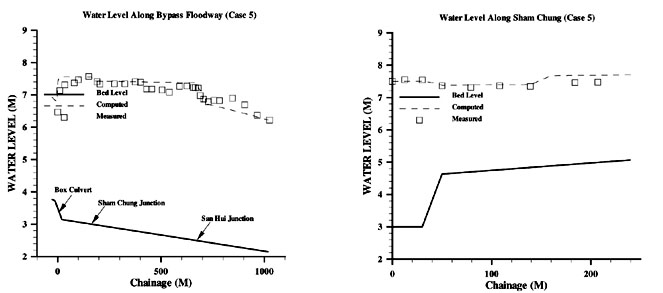
Fig.3 Measured and computed water levels along Sham Chung and Bypass floodway |
||
|
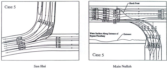
Fig.4 Observed flow pattern of San Hui and Main Nullah junction in Case 5 |