Dynamics of Algal Blooms and Red Tides in Coastal Waters:
Monitoring, Modelling and Prediction
Hydrodynamic Tracking of Algal Blooms (Poster)
Introduction
In this study, we perform hydrodynamic tracking of algal blooms using a calibrated three-dimensional hydrodynamic model of the Pearl River Estuary (Delft3D). Numerical drogues are released at a large number of locations in the northeastern waters, and their paths/trajectories tracked for a wide range of initial and tidal conditions. Particular emphasis is focused on understanding the possible cause of the April 1998 massive red tide and the worst fish kill in Hong Kong’s history.
The
Model
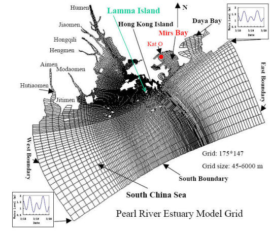
Curvilinear grid of the Pearl River Estuary used in Delft3D simulation
Findings
Dry season (Tracking of the 1998 massive bloom)
In a typical dry season, the flow is mainly from NE to SW. An algal bloom initiated in Mirs Bay would generally move along the NE-SW direction and pass by the eastern edge of Port Shelter and East Lamma Channel. However, in Spring 1998 the numerical hydrodynamic tracking shows that an algal bloom initiated in northeast Mirs Bay (March 18-20) has a much greater chance of being transported out of Mirs Bay under the strong March wind. Bloom patches can then be transported into the East Lamma Channel in early April with the change to southeasterly wind under almost diurnal tidal conditions.
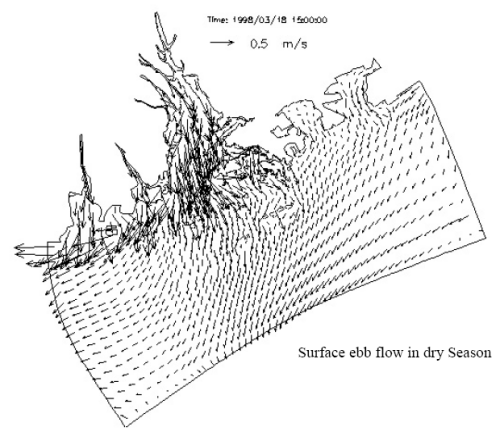
Surface flow field in ebb tide in dry season
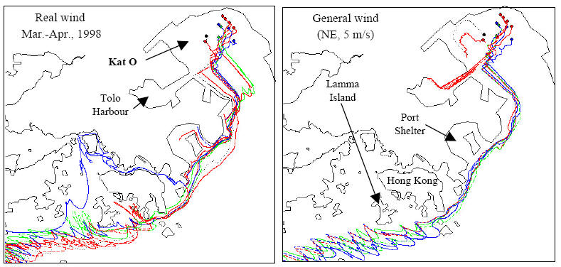
Comparison of algal bloom tracks under the real wind (left) and general wind in dry season (right)
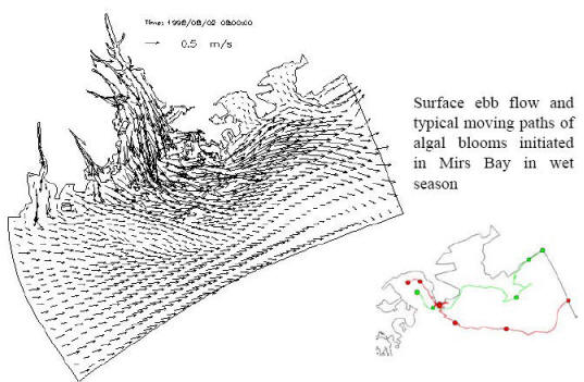
Wet season
In the wet
season, the flow is mainly from SW to NE. The circulation is heavily
influenced by the Pearl river. The interaction of the freshwater flow
with the tidal current results in significant vertical and horizontal
salinity gradients. An algal bloom initiated in Mirs Bay is likely
transported away from Hong Kong waters.